Prof. Dr.-Ing. Timo Balz

balz@whu.edu.cn

Synthetic Aperture Radar - Remote Sensing with Microwaves

Synthetic Aperture Radar (SAR) allows us to see the world differently. SAR systems are used for creating digital elevation models and measure surface motions in millimeter precision. Due to their (almost) all-weather capability, they are also important for many surveillance applications depending on steady data streams.

​

My research focuses on applying Synthetic Aperture Radar data for  measuring surface motion and surface-cover changes over time to better understand our dynamic Earth. Understanding today’s Earth dynamics also requires us to better understand the past and therefore I am also working on using SAR Remote Sensing for landscape archaeology

Five most relevant publications in the last five years:

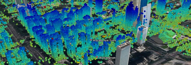
M. Jendryke, T. Balz, S.C. McClure, and M.S. Liao, “Putting people in the picture: Combining big location-based social media data and remote sensing imagery for enhanced contextual urban information in Shanghai,” CEUS , Vol. 62, pp. 99-112, 2017.

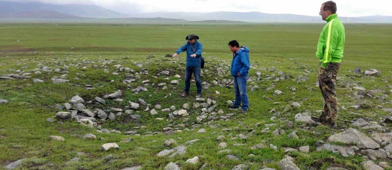
T. Balz, G. Caspari, B.H. Fu, and M.S. Liao, “Discernibility of Burial Mounds in High-Resolution X-Band SAR Images for Archaeological Prospections in the Altai Mountains,” Remote Sensing, Vol. 8(10), 817, 2016.

T. Balz, H. Hammer, and S. Auer, “Potentials and Limitations of SAR Image Simulators – A Comparative Study of Three Simulation Approaches,” ISPRS Journal of Photogrammetry and Remote Sensing, Vol. 101, pp. 102-109, 2015.

L. Wei, T. Balz, L. Zhang, and M.S. Liao, “A Novel Fast Approach for SAR Tomography: Two-step Iterative Shrinkage / Thresholding,” IEEE GRSL Remote Sensing Letters, Vol. 12 (6), pp. 1377-1381, 2015.

T. Balz, L. Zhang, and M.S. Liao, “Direct Stereo Radargrammetric Processing Using Massively Parallel Processing,” ISPRS Journal of Photogrammetry and Remote Sensing, Vol. 79, pp. 137-146, 2013.

Activities

Publications

  • Associate Editor of “Remote Sensing”
  • Associate Editor of the “IEEE Geoscience and Remote Sensing Letters”
  • Member of the Editorial Board of “Geo-Spatial Information Science”
  • Chair of the ISPRS working group I/3 on “SAR and Microwave Sensing”
  • Chief Guest Editor for the Remote Sensing Special Issue “Advances in SAR: Sensors, Methodologies, and Applications”
  • Member of the selection committee for the DAAD-CSC Post-Doctoral Scholarship
  • Member of the Scientific Committee of the “ISPRS Geospatial Week 2017”
  • Chair of the “2017 ISPRS International Workshop on Advances in SAR: Constellations, Signal processing, and Applications (SarCon 2017)” organized as part of the “ISPRS Geospatial Week 2017”
  • “Chime Bell Award” of the Hubei provincial government for outstanding contributions in the economic and social development of Hubei province.

Teaching

Microwave Remote Sensing” at the International Academy of GeoInformation, Wuhan University

​

Interpretation of Remote Sensing Images” at the Northeastern University, China

RESEARCH TEAM

Research is not something done alone, but depends on the team. I am happy that we setup such a great, diverse, and international team at LIESMARS. We are working on a variety of SAR and Remote Sensing related topics. With the majority of the students coming from an international background, we are working in an international research environment and working on related problems from different areas.

PROF. DR.-ING. TIMO BALZ

Professor for SAR remote sensing,  measuring surface motion and surface-cover changes over time to better understand our dynamic Earth.

DR. BAHAA MOHAMMADI

Post-Doctoral research fellow, working on combining SAR remote sensing and optical remote sensing, focusing on mountainous areas.

JINGHUI WANG

PhD student, working on precise absolute positioning of SAR data. Currently on exchange with the University Stuttgart, Germany.

MEHDI BENATTOU

PhD student, working on measuring infrastructure stability with SAR data.

ZIYUN WANG

PhD student, working on 3D/4D reconstruction using mono-static and bi-static SAR data stacks

NEEMA NICODEMUS

PhD student, working on machine learning in the context of optical and microwave image understanding.

GROUP PICTURE

Chinese New Year Lunch 2018

RESEARCH PROJECTS

CONTACT

balz (a) whu.edu.cn

Urban subsidence and surface motion monitoring using space borne SAR data. Thanks to the ability to measure slow velocities in millimeter precision.

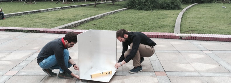
SAR allows for very precise measurement. Here we are preparing for a ground-test as part of the Dragon-4 co-operation between the European Space Agency and the Chinese MOST.

SAR for archaeology is a concept possible with the modern high-resolution SAR sensors. This picture shows our field work in the Altai mountains.